Terrain Processor: Area: Low-density Cluster (strip)
Jump to navigation
Jump to search
Task details
Task name : Area: Low-density Cluster (strip)
Dll plugin name : BITasksPlugin.dll
Geometry type : Polygon, PolygonM, PolygonZ
Heightmap : No
Description
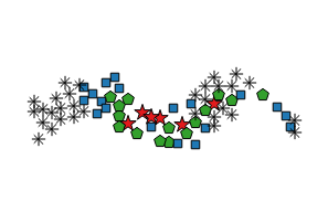
Algorithm used for populating low-density areas. Objects are organized in linear clusters.
Task parameters
- RANDOM SEED - number used to initialize pseudorandom number generator.
- HECTARES - area size in hectares (individual for each shape).
- CDENSHA - The density of the filling in number of clusters for hectare.
Object prototype parameters
- OBJECT - Object's prototype name
- MINHEIGHT - Minimal size in %
- MAXHEIGHT - Maximal size in %
- MINDIST - Minimal distance in meters
- GROUPID - Cluster group id
- MINCOUNT - Minimal count of objects in one cluster
- MAXCOUNT - Maximal count of objects in one cluster
Usage
Similar to the "Area: Low-density Cluster (circle)", creates prolonged clusters of given width. Perfect for small tree groups, or for adding lines of undergrowth into forests.
Algorithm
For each shape (areal) do :
- clusters_count = HECTARES * CDENSHA
- For clusters_count :
- Get random prototypes group.
- Find position inside shape = cluster_center.
- For each object prototype do :
- prototypes_count = random MINCOUNT - MAXCOUNT
- For prototypes_count :
- Get random direction_vector with random length (0 - MAXCRADIUS) from cluster_center.
- If position = cluster_center + direction_vector id inside shape and condition MINDIST[n] is ok, then 3. else 1.
- Create new instance for object prototype in position.

