Enfusion Blender Tools: Import/Export ASC Elevation – Arma Reforger
Lou Montana (talk | contribs) m (Add info log image) |
Lou Montana (talk | contribs) m (Lou Montana moved page Enfusion Blender Tools: Import/Export ASC Elevation to Arma Reforger:Enfusion Blender Tools: Import/Export ASC Elevation: Name standard) |
||
| (One intermediate revision by the same user not shown) | |||
| Line 1: | Line 1: | ||
[[File:armareforger-ebt_asc_file_import_example.png|thumb|800px|Example of procedural terrain editing by sticking terrain vertices to a complex shape and then result imported in World Editor]] | [[File:armareforger-ebt_asc_file_import_example.png|thumb|800px|Example of procedural terrain editing by sticking terrain vertices to a complex shape and then result imported in World Editor]] | ||
This feature allows to import an {{ | This feature allows to import an {{Link|https://en.wikipedia.org/wiki/Esri_grid|ESRI asc grid}} format into Blender as regular grid mesh as well as to export regular grid mesh back to ASC file (and import it in World Editor). | ||
{{Feature|informative|This tool is a very simplistic implementation that imports the whole file at once; therefore, depending on grid resolution, operations may take some time.}} | {{Feature|informative|This tool is a very simplistic implementation that imports the whole file at once; therefore, depending on grid resolution, operations may take some time.}} | ||
Revision as of 22:30, 11 August 2023
This feature allows to import an ESRI asc grid format into Blender as regular grid mesh as well as to export regular grid mesh back to ASC file (and import it in World Editor).
Import ASC File
In the Enfusion Blender Tools menu, use Import > ASC elevation.
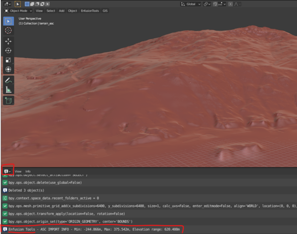
Once the import is done, Min
Export ASC File
Select the terrain object first, then in the BT menu use Export > Terrain to ASC.
Once the export is done, Min/Max elevation and Elevation range info is printed out in Info editor.
Elevation Modification
The elevation of an imported terrain mesh can be modified in various ways in Blender, e.g via Edit/Sculpt mode or by using procedural approaches.
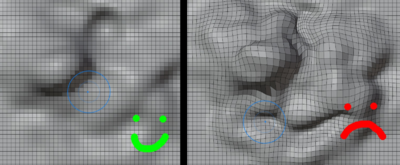
Terrain mesh is represented as a regular grid and must remain as such after any modifications are done to mesh, otherwise elevation changes can appear in a slightly shifted position.
Edit Mode
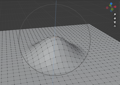
In Edit mode, the safest way to prevent such issue is to only shift vertices in the vertical axis by dragging the gizmo's blue arrow which locks movement to Z (vertical) axis.
Sculpt Mode
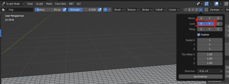
In Sculpt mode, user can prevent vertices shifting in horizontal plane by locking the X and Y axis in the following menu:


