Map ama lowres half tn.gif – File
Jump to navigation
Jump to search
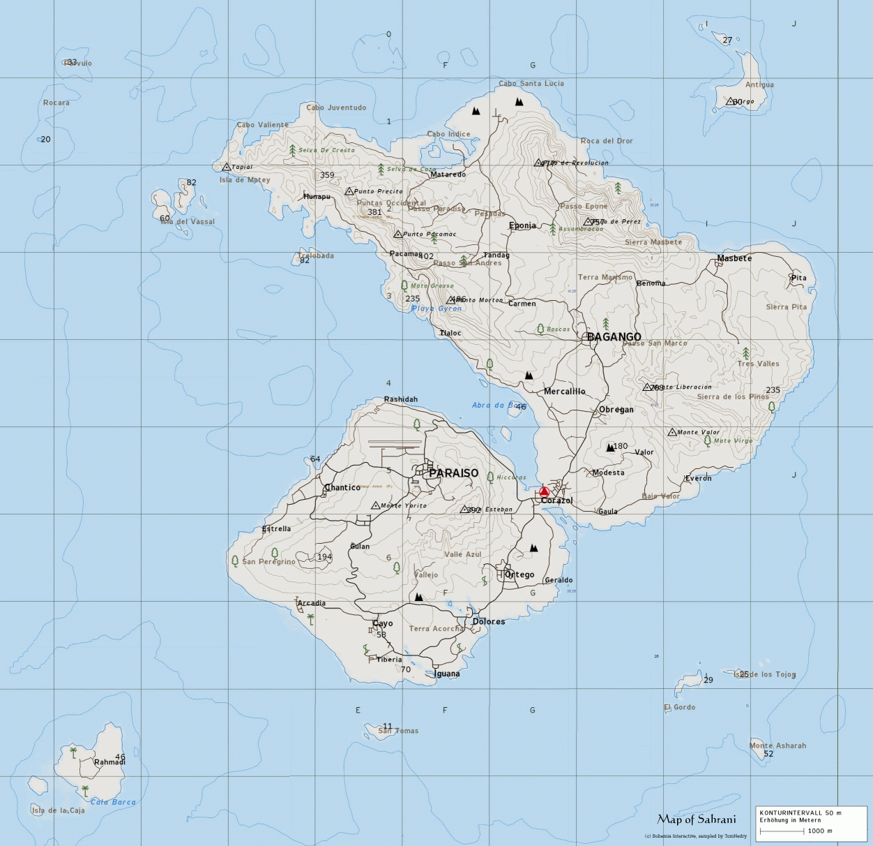
Size of this preview: 619 × 599 pixels. Other resolution: 1,252 × 1,212 pixels.
Original file (1,252 × 1,212 pixels, file size: 400 KB, MIME type: image/gif)
Sahrani topographic map, sampled by TomNedry
File history
Click on a date/time to view the file as it appeared at that time.
| Date/Time | Thumbnail | Dimensions | User | Comment | |
|---|---|---|---|---|---|
| current | 01:36, 29 December 2006 | | 1,252 × 1,212 (400 KB) | TomNedry (talk | contribs) | Sahrani topographic map, sampled by TomNedry |
You cannot overwrite this file.
File usage
The following page uses this file: