Sahrani
Jump to navigation
Jump to search
Introduction
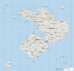
Sahrani (also knowns as Sara) is the Island from which William Porter is posting in his Blog.
Geographical Information
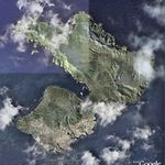
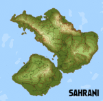
Information gathered from William Porter's blog and other sources indicates that:
- The map is 400km2 in size in total including underwater areas.
- The map is larger than any of the previous Islands, including Nogova, it is about the same size as all four official islands (Everon, Malden, Kolgujev and Nogova) in Operation Flashpoint combined.
- The Island has tropical/Mediterranean-like vegetation in Southern part and European style in Northern part.
- The "real world" coordinates of Sahrani are: 39° 57' 0" N / 40° 1' 12" W, placing it in the North Atlantic Ocean.
Maps
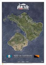
- Downloadable maps
- 72 dpi (2,2 MB)
- 300 dpi (14,7 MB)
- Hi-res map (6923 x 5867) jpg 15mb
- Hi-res map (17520 x 17520) jpg 70 18mb, jpg 100 89mb
Airfields
There are four airfields at Sahrani:
- Paraiso-International
- Runway: 09/27, 1400m, Concrete
- Rahmadi-Airfield
- Runway: 18/36, ?m, Grass
- Pita-Airfield
- Runway: 14/32, 1100m, Grass
- Antigua-Airfield
- Runway: 18/36, ?m, Dirt
